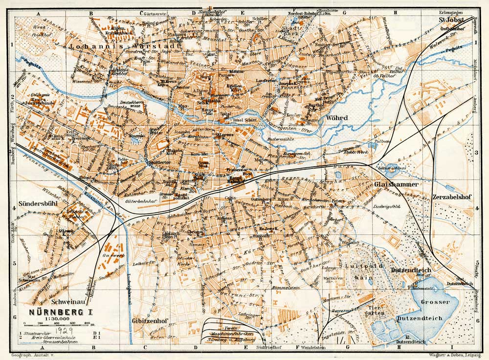
Here is a map from a travel guide of 1929. It shows well the course of the old Pegnitz before the creation of the Wöhrder See. It split into two channels as it entered the Wöhrder Wiese with the northern-most course quite close to the streets. Below is a detail of the area on the upper right (H1) containing the Mögeldorf Railroad Bridge and today's Kindergarden. (High resolution version is available.)
Detail of Bridge Area
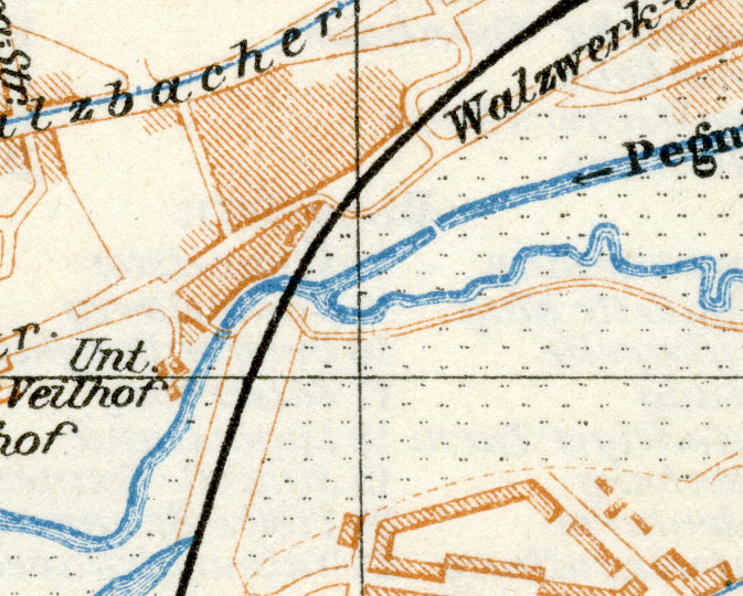
The Pegnitz River goes under the railroad bridge (black line) and swings to the south passing immediately under what I interpret is a small bridge that connnects two roads or paths on either side of the river. Buildings existed just to the west of the river at the label "Unt. Veilhof." This might have been the buiding with the pointed gable seen in the photograph of Konrad, Lena, and her sisters. However, other buildings are present in the shaded areas of this map. I must confess however, that I have difficulty trying to place the camera in a manner that would duplicate the photograph taken some 14 years earlier. As much fun as I have had in working on this, it remains possible that the photograph was taken elsewhere, or that it might not have been taken on a bridge in the first place!
On a separate page, I show a broader area around the bridge together with an overlay of modern Wöhrd.